Dome Kang (7,264m), first ascent and correction of history.
From 2002 to 2009 a group of Spanish mountaineers, which at different times included three doctors (Miriam Ferrer, Marian García and Guillermo Mañana), a climber and cameraman (Dani Salas), a climber and biologist (Elena Goded), a climber and geographer (Pedro Nicolás), and four climbers (Miguel Bonet, Tente Lagunilla, Carlos Soria, and I), explored, climbed, despaired, and finally summited Dome Kang, a previously virgin peak on the Nepal-Tibet border north of Kangchenjunga. It took one reconnaissance trip (in 2002) and three full expeditions (in 2004, 2006 and 2009), before we reached the top.
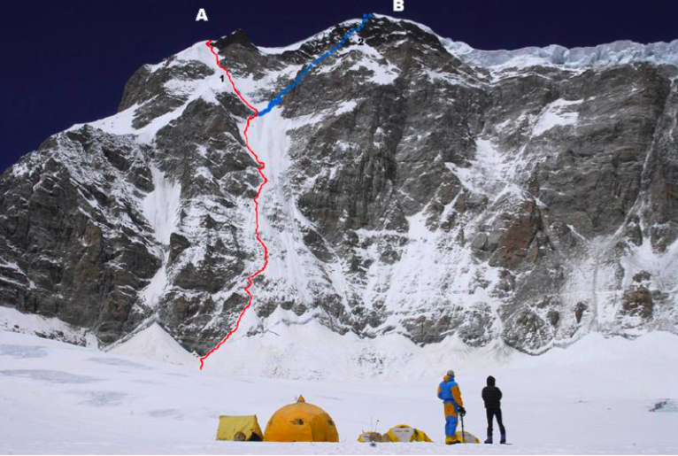
The southeast face of Jongsang as seen from Camp 1 (6,200m). (A) Jongsang South Peak II. (B) Jongsang South Peak I (7,350m). (1) The 2009 Spanish line (snow, ice and mixed to UIAA IV+/V-, ca. 1,000m). (2) Touch of Silence (VI/4: c1,150m: Azman- Markovic, 2000). Dome Kang (7,264m) is some way behind and well to the right of South Peak I. Salvador García-Atance.
Our quest was the solitude of distant and relatively unknown mountains, the pleasures of discovery, and the fulfillment of solving the different challenges found in remote places. However, we faced the restrictions of our own capabilities. We recognized that on peaks above 7,000 m, climbing new routes in alpine style is the most aesthetic approach, but we accepted we didn’t have that sort of ability, and therefore had to live with the classic, heavy-weight expedition, using fixed ropes, Sherpas, etc. We also recognize that without the help from the Sherpas and high-altitude porters, who assisted us during the three expeditions, each trip would have been a nightmare. We had 10 Sherpas throughout the three expeditions but the two that I would most like to mention are Muktu, the Sherpa leader of the first and second trips, and Chang Dawa, leader of the third.
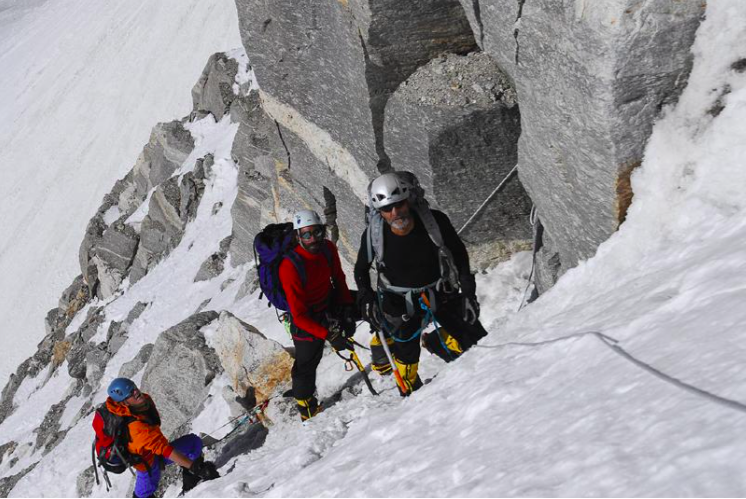
From left to right Miguel Bonet, Dani Salas and Salvador García-Atance in the lower section of central couloir on the southeast face of Jongsang. Salvador García-Atance Collection.
On our first trip in 2002 we wanted to explore Janak (7,041 m), an unclimbed peak on the same plateau as Jongsang (7,462m) and Dome Kang. Officially, it is not possible to approach these peaks from Tibet and Sikkim due to border restrictions, so the only possibility to reach Janak, Jongsang or Dome Kang is to climb the five-kilometer-long and one-kilometer-high barrier that defends the plateau on the Nepalese side. In 2002 we decided that Janak’s south face would not be suitable for a heavy expedition: it was eventually climbed in 2006 by Stremfelj and Zalokar, as reported in AAJ 2007 - a remarkable achievement.
Back in Kathmandu, in the library of our hotel, we found The Kangchenjunga Adventure, the book that covers the 1930 Dyhrenfurth expedition. Due to that accidental encounter, I began the research that convinced me Dome Kang was virgin. Jill Neate, in High Asia (1989), assigned the first ascent of Dome Kang (7,442m) to Dyhrenfurth in 1930 (see also AAJ 2005 and 2007). In the Kangchenjunga book, we read that Dyhrenfurth reached the summit of Jongsang after 1:00 p.m. Afterwards, he went to a subsidiary peak. Someone, somewhere, decided that this peak was Dome Kang.
This isn’t the case. The name Dome Kang characterizes a big dome, and the only big dome on the plateau is a peak to the east of Jongsang, 200m lower, and two kilometers distant. Is it possible that a mountaineer, who at the time had just climbed the highest peak in history, reaching the summit in the afternoon, would descend 300m and then climb up another 100m to summit two kilometers away? The reality was that Dyhrenfurth walked to the end of Jongsang’s South Ridge, a point of altitude 7,442m, to have a look at the Jongsang glacier below and his Corner Camp close to Pangpema. The big dome to the east was unclimbed. That conclusion was the basis of our three expeditions to Dome Kang. (Editor’s note: this is also clear on the HMG-Finn map, where the 7,264m peak is labeled Domekhan. This peak was only brought onto the permitted list after the Spanish asked for a permit to climb).
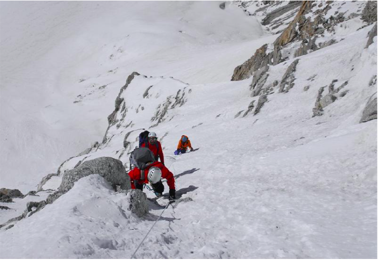
Miguel Bonet, Dani Salas and Salvador García-Atance higher up the central couloir on the southeast face of Jongsang. Salvador García-Atance Collection.
In 2004, we established base camp at Pangpema (5,000m), and then walked up the Jongsang Glacier to Jongsang La (6,100m). We had decided that Dome Kang lay close to the east ridge of the plateau, so the Jongsang La was the natural place to start the ascent. We set up Camp 1 at 6,100m on the east side of the glacier, and tried to climb the east ridge to the plateau. We got to 6,500m but had expended our strength on the glacier and had to go back. In 2006, we now knew the difficulties of the Jongsang Glacier, so we not only set up base camp at Dyhrenfurth’s old Corner Camp (three hours closer to the mountain), but also prepared a complicated logistical system to carry equipment to Camp I (at the same place as on our first expedition). This time we reached 6,700m, but at that altitude the ridge was hazardous, possibly suitable for a strong team climbing in alpine style, but not for us. Back again.
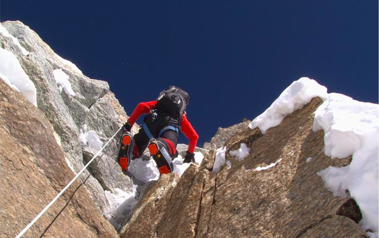
Mixed climbing in the couloir. Salvador García-Atance Collection.
Finally, in 2009 we mastered the logistics, and set up base camp in the middle of the glacier, five hours above Pangpema and only eight hours from Camp 1. On this expedition we placed a new Camp 1 on the west side of the glacier at 6,200m. We also changed our route from the east ridge to the big couloir on the southeast face that was first climbed in 2001 by two young Slovenians (Editor’s note: Urban Azman and Andrej Markovic made an alpine style ascent of the couloir, reaching the summit of 7,350m Jongsang South Peak I in a day. The couloir had previously been attempted to 6,600m in 1998 by an Irish team. Azman and Markovic then traversed toward South Peak II and tried to descend its southeast spur in the dark. Not far into the descent a rappel anchor pulled and Markovic fell to his death). In the first part we found difficult conditions (very icy, with sections of IV+/V- mixed), and we exited via snow ramps to the left, rather than following the couloir up right like the Slovenians. We fixed a total of 1,500m of rope and placed Camp 2 on the plateau at 7,200m. The day after, April 28, Carlos Soria and Tente Lagunilla, with Sherpas Chang Dawa, Karma Gyalzen, and Sonam, walked across the plateau for three hours to the summit of Dome Kang.
We learned by heart the beautiful meaning of the poem by Kavafis:
As you set out for Ithaka,
hope your road is a long one,
full of adventure, full of discovery.
Keep Ithaka always in your mind
Arriving there is what you are destined for
But don’t hurry the journey at all
Better if it lasts for years
So you are old by the time you reach the island Wealthy with all you have gained on the way Not expecting Ithaka to make you rich.